


PROTECT YOUR PROPERTY! THE BENEFIT OF GEO-REFERENCING.

What is Georeferencing? Is it possible that my property “moves”?
Georeferencing is the process of assigning exact locations to geographical objects within a geographic frame of reference. The registration of the georeferenced graphic description of your property with the Land Registry Office consists of the possibility of registering the perimeter delimitation of your property, or in colloquial terms to register the map of your property tied to a known Earth coordinate system.
We know many cases of properties, which by nature are immovable, “moving” on the cadastral map (*A cadastral map is a map that shows the boundaries and ownership of land parcels), as if by magic, to one side or the other, altering the boundaries, surface areas and other elements that are presumed to be fixed.
Often the boundaries of a property are walls which can be seen with the naked eye, but in the cadastre, they are displaced and do not correspond to reality. Of course, there are also many properties without walls, which will make it even much more difficult to interpret the boundaries of your property and it would be very useful to have specific coordinates marking the boundaries of your property. Unmarked boundaries is often a source of conflicts between neighbours.
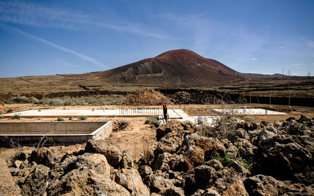
To give an example, imagine that you buy a property where the walls are well defined, a spacious garden and everything seems to be tidy. It turns out that the next-door neighbour has proceeded the process to register the georeferenced graphic map of his property and when he does so the result is that it “theoretically” eats up half of our garden. The problem is that your plot is not georeferenced ans its georeferenced map not registered, and for this reason we have no legal arguments to defend you. Whereas if you had registered the georeferenced map first, we would have guarantees that this half of the garden is and stays yours.
Another example would be this: You start your construction project on a non-georeferenced plot, a plot without registered boundaries to this neighbouring plots, so the boundaries are just vague boundaries. You start building on this plot in accordance with the town planning ordinance in force, respecting the established parameters and investing money and time thinking that everything flows correctly. But suddenly the neighbour claims that your boundary was not where you thought it was; that your boundery is located a few metres further away and that those metres of land you were counting or his property. If the georeferenced map of your property has not been registered and the one of your neighbour is, you may be forced by law to demolish your entire construction project and you might lose everything you have done up to that point, unfortunately. If, on the other hand, the georeferencing has been carried out and registered, then we will be able to tell your neighbour that the boundary of the property is exactly where you say it is.
PROPERTY TITLES DO NOT HELP, and THE CADASTRE DOES NOT HELP. How can we be certain of the exact size of the property that I own?
More and more conflicts are arising between neighbours about which peaces of land belonging to the one or the other. And it is very difficult based on the literal description in the title deeds, to know exactly where your boundaries are.
On top of this, there is the added problem that the Cadastre, which is an administrative register of plans, in many cases reflects properties with boundaries that do not correspond at all with reality.
This means that the wall that you see through your window and that seperates your plot from the neighbouring plot, is probably not shown in this position on the cadastral plan.
When buying or selling a property, you want to know the exact delimitation of your plot. When you are already owner of a property, you want to be sure that the land really belongs to you and that it will not be the object of appropriation by neighbours and adjoining owners.
Did you know that registering the georeferenced map of your property property not also has advantages in terms of legal certainty, but it also has economical advantages?
Will the registration of the georeferenced map of my property offer me legal certainties?
In terms of legal certainty, all property owners, by the mere fact of being registered, will automatically and free of charge enjoy an extremely important legal protection, which, unlike that which can be obtained from the judicial bodies, is unconditional, instantaneous, free of charge and operates ex officio in the interest of the owner. In other words, if you own your georeferenced property and an adjoining property is registered, the delimitation cannot coincide and you will ensure that your registered property remains intact, unless you agree with the delimitation set by the neighbour.
The owner of the registered property will always possess it since “for all legal purposes it will be presumed that the real rights registered in the Register exist and belong to their owner in the form determined by the respective entry” and “will be maintained in their acquisition”.
Are there economic advantages related to the registration of the geo-referenced map of my property?
In addition to the legal advantages of georeferencing, as mentioned above, there are also economic advantages; the value of your property increases and the “sale value” will increase because registered properties can be sold at a higher price.
The “security value” increases because it will be easier to obtain financing by having it georeferenced and thus also registered, and the “auction value” increases because the probability of better offers on a georeferenced property is remarkable. It is also important to note that a property that is geo-referenced will be respected by the public administration when it is expropriated or reordered in the planning.
How to register the geo-referenced map of my property?
The process of geo-referencing and the registration of a geo-reference map is a process by which your property is delimited and registered with its corresponding coordinates so that it is practically immovable, and nobody can take away a few metres of your land.
In this process you can already sense certain conflicts with your neighbours, and it is possible that during the processing of these conflicts there may be opposition to the registration in the way you wish, and that is why it is necessary and so important to be well advised. It can happen that some of the neighbours oppose your registration without any grounds and try to obstruct your rights.
At such times it is necessary to be well advised by professionals who know the legislation and are advised by topography technicians (surveyors). In LAJARES LAW OFFICES we have the best team.
ALL YOU NEED IS LAW, if you want to prevent your neighbours’ land from growing and moving onto your property.
